A Blind Test of the Younger Dryas Impact Hypothesis

The Western Hemisphere. General term for the Americas following their discovery by Europeans, thus setting them in contradistinction to the Old World of Africa, Europe, and Asia.

Moderators: MichelleH, Minimalist, JPeters

User avatar
circumspice
Posts: 1201
Joined: Sat Dec 19, 2009 7:10 pm

Re: A Blind Test of the Younger Dryas Impact Hypothesis

Post by circumspice »

Kalopin wrote: ...and how and why does everyone let E.P. and his constituents get away with making outlandish assumptions with no rebuttal?


Jealous much Tony?

E.P. has actual, real life credentials, unlike your imaginary credentials. They're not much, but they actually exist...

Why don't you put your investigator hat on & check it out? No Tony, not the shiny silver tinfoil hat, one of the other ones... :lol:
"Nothing discloses real character like the use of power. It is easy for the weak to be gentle. Most people can bear adversity. But if you wish to know what a man really is, give him power. This is the supreme test." ~ Robert G. Ingersoll

"Damn with faint praise, assent with civil leer, and, without sneering, teach the rest to sneer." ~ Alexander Pope
E.P. Grondine

Re: A Blind Test of the Younger Dryas Impact Hypothesis

Post by E.P. Grondine »

circumspice wrote:
Kalopin wrote: ...and how and why does everyone let E.P. and his constituents get away with making outlandish assumptions with no rebuttal?


Jealous much Tony?

E.P. has actual, real life credentials, unlike your imaginary credentials. They're not much, but they actually exist...

Why don't you put your investigator hat on & check it out? No Tony, not the shiny silver tinfoil hat, one of the other ones... :lol:
Thanks spice -

E.P. also has data, and had (and to some limited extent, still has) pretty good working abilities.

Tony, as far as my colleagues go, I can speak for them on your hypothesis, and tell you you are very, very mistaken.

Please take a drive down to the Fort Mims and Wetumpka Crater museums.

spice, could you help see to it that tony has plenty of time for that trip?
Kalopin

Re: A Blind Test of the Younger Dryas Impact Hypothesis

Post by Kalopin »

E.P. Grondine wrote:
circumspice wrote:
Kalopin wrote: ...and how and why does everyone let E.P. and his constituents get away with making outlandish assumptions with no rebuttal?


Jealous much Tony?

E.P. has actual, real life credentials, unlike your imaginary credentials. They're not much, but they actually exist...

Why don't you put your investigator hat on & check it out? No Tony, not the shiny silver tinfoil hat, one of the other ones... :lol:
Thanks spice -

E.P. also has data, and had (and to some limited extent, still has) pretty good working abilities.

Tony, as far as my colleagues go, I can speak for them on your hypothesis, and tell you you are very, very mistaken.

Please take a drive down to the Fort Mims and Wetumpka Crater museums.

spice, could you help see to it that tony has plenty of time for that trip?
what "data" E.zP.z? [do you work in the aerospace industry to?]
The dating process is flawed. Wetumpka is not that old...

So, give us some more data pertaining to your cometary airburst theory... Please explain how an atmospheric explosion would produce all the effects of the younger dryas event... [waiting...]

[Well, [sugaSpice] you all coulda' [shoula' woulda'] just let it go and saved yourselves from even more embarrassment, but no,... It makes me think that you all really do not understand the accuracy of my research...]
[...and so here we are back at the beginning-]
Do you all understand what the Mississippi embayment is? How much have you all studied the formation of the embayment?, the Ozarks?, the Smokies,...?
You understand that the Mississippi embayment is a massive, deep crease, where the north American plate was bent inward on itself, leaving a large trench?-
Image[-profile]
http://www.sciencedirect.com/science/ar ... 0702000194
This line of volcanism coincides with the predicted Bermuda hotspot path and has isotopic signatures consistent with a mantle hotspot source. We propose that...
...yes, the mantle plume did greatly effect the underside of the north American plate as it passed over, but was not what formed the crease...
https://www.deepdyve.com/lp/elsevier/ne ... H8kOcZiMdh
...the cause of today's relatively high rate of tectonic activity in the Mississippi embayment remains elusive...
...oh, honesty... [the seismographs are recording internal landslides- see Seth Stein's research...]

...and so, how was such a deep crease in a tectonic plate formed? Yes, it would take such a massive impact, as from this planet's largest satellite to push down, pinching and folding the plate and, at this same moment, exhuming massive amounts of limestone from beneath ancient seas to form the Ozarks and scraping the surface sediments [animals, plants,...] to form the Appalachias, and so forth...

Do you understand how all of this is connected? Look at the limestone covering the Yucatan, follow it up to the Ozarks. Yes, the colder rock stayed to the north, the hotter ejecta fell toward the equator, as gravity will be a big indicator of this event. The reason there is vitrified sand, fractal kinetics, radiation, natural glasses,... throughout Libya, as the finer material out of the ejecta blanket settled southward, covering all the pyramids and temples and forming the Sahara desert... and makes perfect sense that the thicker, hotter limestone ejecta fell to form the Kasha-katuwe tent rocks along with all the other mountainous anomalies throughout the southwest U.S. The reason that the dinosaur bones are so full of radiation... The reason for devolution, the loss of so much of the technology and the recorded history that had accumulated up to the end of the Pleistocene, as civilizations and highly intelligent life go way back, much further in time...
http://www.goldlibrary.com/metal_library.html
... finally accepting the Tayos metal library and treasures had to exist! Packed with scientific and historical information but lacking an ancient script in South America he distilled from Mytho-history a model of The Origins of the Solar System and Humanity that might accommodate the metal library...

... and a more astounding 'crystal' library that accompanies it! ...
There were attempts to save many documents and historical accounts, much of which has been destroyed [mostly due to ignorance, superstition, religious fanaticism, incompetence,...]
There are those with better understanding and would want to keep this information hidden to the general public...

...if you all insist on continuing, I will divulge enough evidence to show the multitude of misperceptions within your current education and beliefs systems...
Why don't you put your investigator hat on
E.P. also has data
...well- waiting?
User avatar
circumspice
Posts: 1201
Joined: Sat Dec 19, 2009 7:10 pm

Re: A Blind Test of the Younger Dryas Impact Hypothesis

Post by circumspice »

Waiting for what Tony?

You're starting to disassociate again... You don't respond well to criticism do you Tony?

Your incoherent magnum opus is garbled trash that was lifted off the internet & pasted in with other unrelated topics. You won't be 'teaching' anyone anything with that stinking, hot pile of bullshit.

Face it Tony, the only place you have any semblance of credibility is in the asylum, with the other patients.
"Nothing discloses real character like the use of power. It is easy for the weak to be gentle. Most people can bear adversity. But if you wish to know what a man really is, give him power. This is the supreme test." ~ Robert G. Ingersoll

"Damn with faint praise, assent with civil leer, and, without sneering, teach the rest to sneer." ~ Alexander Pope
Kalopin

Re: A Blind Test of the Younger Dryas Impact Hypothesis

Post by Kalopin »

circumspice wrote:Waiting for what Tony?

You're starting to disassociate again... You don't respond well to criticism do you Tony?

Your incoherent magnum opus is garbled trash that was lifted off the internet & pasted in with other unrelated topics. You won't be 'teaching' anyone anything with that stinking, hot pile of bullshit.

Face it Tony, the only place you have any semblance of credibility is in the asylum, with the other patients.
[duh] waiting for E.P. to defend his hypothesis, as I have mine...
...like you, he just spouts out insults, looks for something personal to attack, avoids all the legitimate information pointing directly to my theory and pretends he knows what he's talking about...
[...at least E.P. has tried to give some explanation, unlike your unintelligible remarks...]
...and WHAT "criticism? You have only tried your best to give some personal attacks and have presented absolutely zero evidence to refute my research... [you have failed!]
My paper has been published in a scientific journal, [get over it!] and now will find more attention and be verified as accurate...
and so, if you truly believe my hypotheses are not viable, then it should be easy for you to argue your point and to prove me wrong- [well- waiting on this as well...]
[tell ya' what-] why don't you go through what is currently being taught and defend all the stupidity?
let's start with the Ozarks-
- Ozarks - Wikipedia, the free encyclopedia
en.wikipedia.org/wiki/The_Ozarks

The Ozarks, also referred to as the Ozark Mountains, ... in reference to the dozens of natural bridges formed by erosion and collapsed caves in the Ozark region.
What formed the ozark mountains - Yahoo Answers Results
How was the Ozark and Ouachita mountains in Arkansas formed ?
1 answer

The presently accepted theory of origin for the Ozarks & Ouachitas is that during the millions of years when parts of the state were being submerged, uplifted, and re-submerged in warm, shallow seas, the Ozark region was being slowly and...
The Arkansas River flows through the Ozark Plateau and between what two...
1 answer

The Ozark Plateau is bounded on the southwest by the Neosho River, on the south by the Arkansas River, on the north by the Missouri and Osage rivers, and on the east by the Black River. The Boston Mountains are the highest section of the...
What rivers run through the Ozark Plateau in Oklahoma?
4 answers

The Ozark Plateau is bounded on the southwest by the Neosho River, on the south by the Arkansas River, on the north by the Missouri and Osage rivers, and on the east by the Black River. The Boston Mountains are the highest section of the...

48 related questions
Ozark Mountains
theozarkmountains.com/ozark_mountains.h...

The Ozark Mountains ... The Ozarks are among the oldest mountain ranges on ... It is truly amazing how the Ozark Mountains were formed and the ...
How were the ozark mountains formed - Answers.com
www.answers.com › … › Missouri › Ozark Mountains

How were the ozark mountains formed? SAVE CANCEL. already exists. Would you like to merge this question into it? MERGE CANCEL. already exists as an alternate ...
What Formed the Ozark Mountains - Image Results
Owls' Knob... Tales of the Ozark Mountains: Transformations over Time
Photo 9 - Aerial Photographs of Fall Foliage in the Ozarks
... Buffalo National River Area in the Ozark Mountains. A hiker's dream
... Mountains. Together, the Ozarks and Ouachita Mountains form an area

More What Formed the Ozark Mountains images
USGS Geology in the Parks
geomaps.wr.usgs.gov/parks/province/inthigh.html

... Ouachita-Ozark Interior Highlands: ... eroded mountains of the Ouachita-Ozark Highlands stand surrounded by the nearly flat-lying ... formed by the earlier ...
The Origin of the Geology in the Vicinity of the...
www.sjsu.edu/faculty/watkins/ozarks.htm

The Origin of the Geology in the Vicinity of the Ozark Mountains There is a newly devoloped theory which explains some of the geological anomalies of the Ozark region.
Geography and Geology - Encyclopedia of Arkansas
http://www.encyclopediaofarkansas.net/e ... try-detail...

Geography and Geology. ... Formation of the Ozark Mountains Natural Division ... the Appalachians were formed, ...
Ozark Plateaus - Arkansas Geological Survey
www.geology.ar.gov/education/ozark_plateaus.htm

AGS / Education / Geology Resources / Physiographic Regions / Ozark Plateaus. The Ozark Plateaus Region is a thoroughly dissected area with steep ... Boston Mountains ...
Ouachita Mountains - Encyclopedia of Arkansas
http://www.encyclopediaofarkansas.net/e ... try-detail...

The Ouachita Mountains, ... formed as silica precipitated out of solution in hot water ... Contrast with the Ozark Mountains The Ouachita Mountains Natural ...
Ozark Mountains | mountains, United States |...
www.britannica.com/place/Ozark-Mountains</...

Ozark Mountains, also called Ozark Plateau, heavily forested group of highlands in the south-central United States, extending southwestward from St. Louis, ...
Ozark Mountain Region
ozarkmountainregion.com

... the Arkansas Ozark Mountain Region offers exciting, ... The Arkansas Ozarks provide a stunning backdrop for a long vacation or weekend getaway fun.

Also try
where are the ozark mountains located the ozark mountains in arkansas
the ozark mountains the ozark mountains missouri
things to do in the ozark mountains native american names for raccoons
map of the ozark mountains facts about the ozark mountains
now, do they look like they were formed over "millions" of years? They are almost all limestone, jutting out in a westerly projection and in the same angle and direction as the Mississippi embayment, the Appalachias, the Grand canyon [which was also created by an electrical arc at impact], the curvature of the Atlantic and Pacific coastline, on and on,... as every single detail argues my point and points directly to the fact that the Mississippi embayment, Mediterranean sea and Hudson bay are three of the world's largest impact sites- astroblemes!
[...or you can prove me wrong?! good luck! ;-]
User avatar
circumspice
Posts: 1201
Joined: Sat Dec 19, 2009 7:10 pm

Re: A Blind Test of the Younger Dryas Impact Hypothesis

Post by circumspice »

the Grand canyon [which was also created by an electrical arc at impact]
:lol: Keep those non sequiturs coming Tony. They're quite diagnostic of your mental status & sometimes mildly amusing.
"Nothing discloses real character like the use of power. It is easy for the weak to be gentle. Most people can bear adversity. But if you wish to know what a man really is, give him power. This is the supreme test." ~ Robert G. Ingersoll

"Damn with faint praise, assent with civil leer, and, without sneering, teach the rest to sneer." ~ Alexander Pope
Kalopin

Re: A Blind Test of the Younger Dryas Impact Hypothesis

Post by Kalopin »

circumspice wrote:
the Grand canyon [which was also created by an electrical arc at impact]
:lol: Keep those non sequiturs coming Tony. They're quite diagnostic of your mental status & sometimes mildly amusing.
dang, you act as if I have not given study, like you!- http://www.holoscience.com/wp/mars-and- ... nd-canyon/
← Comet Borrelly rocks core scientific beliefs
Charge Separation in the Mind →
MARS and the GRAND CANYON
Posted on October 24, 2001 by Wal Thornhill

“The ultimate objective of comparative planetology, it might be said, is something like a vast computer program into which we insert a few input parameters (perhaps the initial mass, composition and angular momentum of a protoplanet and the population of neighboring objects that strike it) and then derive the complete evolution of the planet.”

Carl Sagan, The Solar System, Scientific American, September 1975, p.29.

First Law of Computing: Garbage in = garbage out.

Most people would think that experts agree on an explanation for the formation of such a grandiose site as the Grand Canyon. Surprisingly that isn’t so. It is an enigma. The latest attempt to figure it out occurred as late as June last year at the Grand Canyon Symposium 2000. The Colorado River is held generally responsible for carving the Canyon. However, even before the Glen Canyon dam stemmed its awesome desert floods, the river seems hopelessly inadequate to have formed such a geological spectacle. The Colorado River flows west from the Rockies and encounters a raised plateau known as the Kaibab Upwarp. Instead of turning away from that barrier it continues through the plateau. How could it do that? The river is much younger than the Kaibab Upwarp so it could not have progressively cut the Canyon even if the land rose very slowly. In any case, most of the material that was removed from the Canyon seems to be missing, according to a report from the symposium, leaving little evidential support for the original theory that a simple progression of water erosion formed the Canyon we see today. Since the 1930’s and 1940’s, geologists have searched for other explanations — that the Canyon once drained to the south-east (reversing the route of the present-day Little Colorado, then joining the Rio Grande and into the Gulf of Mexico. When problems arose with that explanation too, it was proposed that it once flowed NE along one of the present-day side tributaries such as Cataract Creek.

The Grand Canyon

See: http://www.kaibab.org/geology/gc_geol.htm#how and The New York Times, June 6 2000, Making Sense of Grand Canyon’s Puzzles by Sandra Blakeslee]

Now let us consider a 21st century solution to the question of how the Grand Canyon was formed, based not only on Earthly evidence, but also on data returned by space probes and produced by more than a century of experimental and theoretical work in plasma laboratories.

The Grand Canyon has often been compared in form, if not size, to the gigantic canyons of Valles Marineris on Mars. Because of these similarities it was initially thought that Valles Marineris was caused by massive water erosion at some earlier, supposedly wetter, epoch in Martian history. That idea has been abandoned because the evidence for water erosion and ponding in Valles Marineris is missing. The favored explanation now is that the surface of Mars has opened up with a giant tectonic rift, rather like the East African rift valley. Rifting is usually accompanied by vulcanism caused by increased heat flow from the interior. Yet major volcanic features are lacking in Valles Marineris. There are also many deep yet short tributary canyons, which require a different explanation. The favored one is undercutting by groundwater erosion. Both on Earth and Mars the canyons seem to have been cut cleanly into a raised flat surface. There is very little collateral damage to that surface. Is it likely that two different causes could end up creating landforms on two planets that look so similar?

The Grand Canyon and Valles Marineris

Both vast canyons confront us with enigmas. Is there a simple answer?

At the heart of geology and planetary studies is a reasoning process called abduction. It is a form of logic whose major premise is certain and minor premise is probable. Then let us consider the question of flowing-liquid erosion. The major premise is “all sinuous channels are formed by a flowing liquid” and the minor premise is “Nirgal Vallis on Mars is a sinuous channel.” The deduction follows that “Nirgal Vallis was formed by a flowing liquid.”

Nirgal contextHowever such reasoning can be hopelessly misleading if the major premise is not certain. Mars is a desert planet with no possibility of flowing liquids today nor, it seems, for a long time past. But the huge channels look as if they were carved yesterday. That should be sufficient to doubt the major premise. However lazy logic forces us simply to conclude that there must have been large quantities of liquid water on Mars in the past. That is the present consensus. So typically the missing water has been conveniently consigned out of sight, beneath the Martian surface. The same thing was said of the channels on the Moon before the Apollo missions proved otherwise. Once again this incurious approach has led to huge expenditure on new spacecraft to detect sub-surface ice on Mars.

What if the major premise is completely wrong? What if none of the sinuous channels (usually called ‘rilles’) on Mars, Venus and our Moon, were originally formed by flowing liquids? This is a key question to be answered before we can address the more complex canyons on Mars and here on Earth. Rilles have the same form on all of these bodies, yet no one today seriously suggests that we look for water on the furnace-hot surface of Venus or on the airless Moon. Instead, hot fluid lava has been called upon as the flowing liquid on these bodies. The problem is that the lava had to remain liquid over hundreds, and in some cases thousands, of miles. So a roof of rock was added, to form lava tubes. But some of those roofs needed to be miles wide! Some rilles on the Moon and Venus are wider than the longest lava tubes on Earth. And the rock roofs had to collapse later to expose the channels. There is no rubble from collapsed roofs in any of the rilles. The rilles are cleanly chiselled into the surface. The lava is supposed to have flowed billions of years ago on the Moon, and only millions of years ago on Venus.

A good example of a lunar rille, photographed in great detail by the Apollo astronauts, is Schröter’s Valley. The channel looks brand new. Once again, the liquid that is supposed to have cut the channel is missing – there is no lava outflow. And lava cannot seep into the ground and be hidden as water can. Something is wrong with this picture. The major premise must be wrong.

Schroter's Valley

There are many more mysterious features of these channels. Their wider “outflow” end is higher than the narrow “source” end, as if whatever formed them was not responding to gravity. In flagrant breach of that law, some run both uphill and down with no sign of the damage that might be expected if the topographical changes were due to later vertical movement of the terrain. Others cut through mountain ridges as if they were not an obstacle. Unlike rivers, rilles often run in parallel. Some have circular craters along their length, others seem to be formed from a continuous series of pits. Most terminate on a crater. Because of the many craters found in and around them, dating the rilles by crater counting makes them appear older than the surface they cut into. The channels are often much more sinuous for their width or the slope of the surface, than would be expected if they had been carved by a liquid. Some have a smaller, more sinuous channel in the floor of the larger channel. Some have flat floors and steep walls. Others have a deep V-shaped cross-section. Tributaries, if any, are often short, end in a circular alcove, and join the main channel at near right angles. To explain these (on worlds with water), recourse is usually made to underground water flows that remove soil and cause collapse and progressive headward erosion of the channel. Many channel floors show transverse markings or small ridges. On Mars they have been described as sand dunes. Many channels have material heaped up on each side to form levees. There are neither catchment areas nor systems of feeder streams sufficient to carve the often-gigantic main channels or tributary streams. The source and sink of the water remains invisible. And the question remains: where did the eroded soil go?

“The real actors on the stage of the universe are very few, if their adventures are many. The most ‘ancient treasure’ -in Aristotle’s words- that was left to us by our predecessors of the High and Far-off Times was the idea that the gods are really stars, and that there are no others. The forces reside in the starry heavens, and all the stories, characters and adventures narrated by mythology concentrate on the active powers among the stars, who are planets.” Giorgio Di Santillana and Hertha von Dechend in Hamlet’s Mill.

“The thundergod is regarded as the most powerful of all the gods of heaven and earth, since the effects of his anger are so terrible and so evident.” Christopher Blinkenberg in The Thunderweapon in Religion and Folklore.

See http://www.users.qwest.net/~mcochrane/T ... rgods.html

The answer has been available for 30 years! It was provided by an engineer, the late Ralph Juergens, of Flagstaff, Arizona. In a brilliant series of papers that would not be published in a mainstream scientific journal, he showed that flowing liquids are not adequate or even necessary to explain river-like channels on planets and their moons. He showed how the strange features of those channels could be simply scaled down and matched against the kind of damage caused by powerful lightning strikes on Earth. So even if Mars had surface moisture in the past its vast channels were not carved by rushing water.

Earth rille< Example of a powerful lightning strike at Baker, Florida in 1949. It furrowed the infield for 40 feet during a baseball game, killing 3 players and injuring 50 others. The more sinuous path taken by the lightning can be seen as a smaller trench in the bottom of the furrow. National Geographic, June 1950, p.827

When we look at the pattern of a lightning scar on Earth we see the features of sinuous rilles in miniature. Electrical phenomena exhibit the same forms from the scale of centimeters to the scale of thousands of kilometers. In fact, it has been shown in high-energy electrical experiments that the same patterns of behavior can be scaled up yet another 100 million times. Because of this, the forms of scars on insulators and semiconductors and/or the surface erosion of spark-machined objects, seen under a microscope, can be used as analogs of electrical scarring of planetary surfaces. Plasma cosmology can do inexpensive controlled experiments on Earth to answer puzzles that have plagued planetologists for decades.

Lightning strike on a golf course

Without a shadow of a doubt, Valles Marineris is an electrical arc scar. It bears the hallmarks, writ large on a planet’s face. Juergens identified it as such 30 years ago from the early Viking Orbiter spacecraft images.

“… to me this entire region resembles nothing so much as an area sapped by a powerful electric arc advancing unsteadily across the surface, occasionally splitting in two, and now and then-weakening, so that its traces narrow and even degrade into lines of disconnected craters. …I can only wonder: Is it possible that Mars was bled of several million cubic kilometers of soil and rock in a single encounter with another planetary body? Might the Canyonlands of Mars have been created in an event perhaps hinted at by Homer when he wrote: “Athena [Venus) drove the spear straight into his [Ares’ (Mars’)] belly where the kilt was girded: the point ran in and tore the flesh… [and] Ares roared like a trumpet…”

Juergens’ explanation requires a dynamic recent history of the solar system, entirely different from the one we have been taught to believe. It highlights an electrical dimension to astrophysics which is nowhere to be found in their textbooks. So it is little wonder that geologists are clueless when confronted with electrical erosion. When planets come close, gargantuan interplanetary lightning results. It is perfectly capable of stripping rock and gases from a planet against the puny force of gravity. It does so leaving characteristic scars. It can explain why some two million cubic kilometers of material is missing from Valles Marineris along with 90% of the atmosphere Mars was expected to have. A subsurface arc through an electrically coherent stratum can explain the peculiar morphology of Valles Marineris. The parallelism of the canyons is due to the long-range magnetic attraction of current filaments and their short-range strong electrostatic repulsion. Particularly significant are the small parallel rilles composed essentially of chains of craters. A traveling underground explosion follows the lightning streamer and cleanly forms the V-shaped tributary canyons. There is no collapse debris associated with undercutting water flow. Similarly, the “V” cross-section is usual for craters formed by underground nuclear explosions. The circular ends of the tributaries, where the explosion began, are precisely of that shape. In comparison, headward erosion by ground water sapping gives a U-shaped cross-section and does not necessarily end in a circular alcove. Note that some of the tributary canyons on the south rim of Valles Marineris cut across one another at near right angles. This might be due to repeated discharges from the same area chasing the main stroke as it travelled along Ius Chasma. No form of water erosion can produce crosscutting channels like that. The fluted appearance of the main canyon walls is probably due to the same travelling explosive action.
Ius Chasma

The system of V-shaped tributary canyons along the south rim of Ius Chasma on Mars (7°S, 82°W).

The walls of Valles Marineris shows evidence of widespread sedimentary layering on Mars. But such enormous quantities of sediment must have eroded from somewhere and the fact that any ancient highlands are preserved on Mars is difficult to reconcile with such a source. A second major difficulty is that Valles Marineris is near the top of a bulge 10 km above datum. How are sediments deposited at that altitude? It would require the region first being a deep basin to collect a thick stack of sediments (assuming there was copious fast-running surface water), then uplifted an incredible 20 km by a mantle plume and voluminous lava intrusions with little surface volcanism.

How many major premises in geology are wrong? The electrical model provides a far simpler solution never considered before in sedimentation. The material removed electrically from one body in a cosmic discharge is transferred in large part to the other body. That creates widespread surface layering. The airless Moon shows evidence too of extensive layering and it is covered in electrical scars.

The arguments for the electrical sculpting of Valles Marineris apply equally to the Grand Canyon. These major features on two very different planets look so similar for the simple reason that the same forces created them. Water was not involved in the process. Let us note the similarities. The Grand Canyon is on a high plateau. The tributaries are deeply incised, short, and tend to end in rounded alcoves. The tributary canyons of Ius Chasma are strikingly similar to those of the Grand Canyon. The material excavated from the Grand Canyon seems to be missing. On a watery Earth, the Colorado river simply took advantage of the sinuous channel carved by the subsurface cosmic lightning. The edges of the Grand Canyon are sharp and do not show much erosion into the mile deep valleys. That argues for very recent formation. Geologists cannot decipher the history of the Grand Canyon because their training never envisaged electrical erosion as a result of interplanetary thunderbolts. Nor did it teach that thick strata and anomalous deposits can be dumped from space in hours. Interplanetary electrical forces can raise mountains, twist and overturn strata, dump oceans on to land, preserve shattered flora and fauna in the rocks – all in a geological instant. But since Lyell, geologists have managed to lull us all into insensibility with vast time spans and piecemeal explanations for each morphological feature of the landscape. The question that should be asked is whether the slow causes they invoke are sufficient to the task they are asked to perform. Fossils do not form under normal circumstances. The sharp outlines of mountains and the tortured strata within them look like still frames from a dramatic action movie. And when it comes to assigning ages, cosmic thunderbolts cause radioactivity, change radioactive decay rates, and add and subtract radioactive elements. So the the assumptions underpinning the rickety edifice of geological dating will need re-examination without prejudice. Geologists are between a rock and a hard place because the main claim of geology to being a “hard” science has come from its bold claims to chart the history of the Earth. But it is clear that the chart they have been handed by cosmogonists and the clock bequeathed by the physicists are equally worthless.

Devon Island mapIt is interesting to find that NASA and the SETI Institute have set up a base camp on Devon Island, Nunavut Territory, in the Canadian high arctic, for the scientific study of the Haughton impact crater and its surroundings. The joint study is known as the Haughton Mars project because the unexplored island is considered a Mars analog. Mars analogs are sites on the Earth where geologic features approximate those encountered on Mars. Devon Island has channels described as glacial meltwater networks. Several types of valleys resemble those seen on Mars. The resemblance appears to be more than superficial, as the similarities are often specific and unique. They have been compared to the tributary canyons of Valles Marineris and are claimed as perhaps the clearest evidence for episodes of sustained fluid erosion on Mars by water. However they present many unusual characteristics that cannot be explained by water erosion:

the valleys are spaced apart with large undissected areas between valleys,
the valleys display open, branching patterns with large undissected areas between branches,
branches often have ill-defined sources but mature in width and depth over short distances relative to the size of the network,
branches maintain relatively constant width and depth over long distances,
branches split and rejoin to form steep-walled islands,
branches have V-shaped cross-sections which transition to larger U-shaped troughs with steep walls and flat floors,
channels on valley floors are absent or poorly expressed. Their scale also varies over an order of magnitude.

Devon Island valleysDevon Island valley< Aerial photograph of a 1 km-wide, deeply-incised, winding, V-shaped glacial trough valley on Devon Island with its tributaries. Note that the surrounding plateau is otherwise little dissected and that there are no major streams feeding onto this canyon. (Photo: NASA HMP)

V-shaped Devon Island valley. >

Here we have a different explanation from geologists for essentially the same morphological feature. The Devon valley networks are merely interpreted to be glacial meltwater channel networks formerly lying under an ice sheet. Some valleys do have a little ice in them today. However, the arguments for their formation by the action of ice make little sense. It suggests that glacial melting on a cold desert planet formed some Martian valley networks, which is hardly helpful. The strong similarities between the Devon valley networks and the tributaries of Valles Marineris, like that of the Grand Canyon to Valles Marineris, is simply because they were formed by the same process – a cosmic electric discharge. All of the unusual features listed above are expected in cathode erosion.

Even the nearby Haughton crater is to be expected, for the same reason that rilles on other planets and moons are associated with craters and often have more craters than the surrounding landscape. The Haughton crater is simply the scar of a cosmic thunderbolt, like practically every other circular crater in the solar system. So NASA is correct in their choice of analog, but wrong in their attribution of causes. In light of more than a century’s research in the field of plasma cosmology and the 20th century discoveries of the space age, we can confidently propose the celestial thunderbolt as a common cause of the formation of canyons and rilles on rocky planets and moons.

See: http://www.arctic-mars.org/docs/03c.LPSC.pdf

There is a geological perspective on planetary scars available at: http://disc.sci.gsfc.nasa.gov/geomorphology/GEO_10 where the difficulties facing geologists are often expressed. With the perspective offered here you may begin to form your own opinion.

Print this page
This entry was posted in EU Views. Bookmark the permalink.
← Comet Borrelly rocks core scientific beliefs
Charge Separation in the Mind →

Open Astronomy Journal
In 2011 five papers on Plasma Cosmology were published in a Special Issue of the Open Astronomy Journal. My Paper Towards a Real Cosmology in the 21st Century can be downloaded as a PDF here.
EU2014 Conference Videos
View the presentations from EU2014 on the Thunderbolts website.
Space News
Visit Space News from the Electric Universe, space news as it is supposed to be. Rather than nonsensical pronouncements of the impossible, the Electric Universe offers an understandable take on the latest space observations.
...do you believe I am alone in my investigations? http://www.datasync.com/~rsf1/1811.htm
Comets, Earthquakes, Meteors, Near Earth Objects, New Madrid Seismic Zone, Tecumseh
[...even if I have to copy and paste every bit..., ...even if I have to force-feed..., ...you WILL see this evidence and it will be known as fact..., ...as it is what had actually occurred..., ...who here wants to learn the truth?]
[let's do this!...:-]
Image
Grand canyon and Valles Marineris [on Mars]
Image
Without a shadow of a doubt, Valles Marineris is an electrical arc scar. It bears the hallmarks, writ large on a planet’s face. Juergens identified it as such 30 years ago from the early Viking Orbiter spacecraft images.
...is this too much info. to go through and understand?...
User avatar
circumspice
Posts: 1201
Joined: Sat Dec 19, 2009 7:10 pm

Re: A Blind Test of the Younger Dryas Impact Hypothesis

Post by circumspice »

[...even if I have to copy and paste every bit..., ...even if I have to force-feed..., ...you WILL see this evidence and it will be known as fact..., ...as it is what had actually occurred..., ...who here wants to learn the truth?]
[let's do this!...:-]


No Tony... We are getting a clearer picture of your mental state with every new post you make...

Do you honestly believe that you can force feed this bullshit on us & then force us to believe/acknowledge you? If so, you are truly more delusional than you appear...
"Nothing discloses real character like the use of power. It is easy for the weak to be gentle. Most people can bear adversity. But if you wish to know what a man really is, give him power. This is the supreme test." ~ Robert G. Ingersoll

"Damn with faint praise, assent with civil leer, and, without sneering, teach the rest to sneer." ~ Alexander Pope
User avatar
circumspice
Posts: 1201
Joined: Sat Dec 19, 2009 7:10 pm

Re: A Blind Test of the Younger Dryas Impact Hypothesis

Post by circumspice »

Kalopin wrote:
circumspice wrote:
the Grand canyon [which was also created by an electrical arc at impact]
:lol: Keep those non sequiturs coming Tony. They're quite diagnostic of your mental status & sometimes mildly amusing.
dang, you act as if I have not given study, like you!- http://www.holoscience.com/wp/mars-and- ... nd-canyon/
← Comet Borrelly rocks core scientific beliefs
Charge Separation in the Mind →
MARS and the GRAND CANYON
Posted on October 24, 2001 by Wal Thornhill

“The ultimate objective of comparative planetology, it might be said, is something like a vast computer program into which we insert a few input parameters (perhaps the initial mass, composition and angular momentum of a protoplanet and the population of neighboring objects that strike it) and then derive the complete evolution of the planet.”

Carl Sagan, The Solar System, Scientific American, September 1975, p.29.

First Law of Computing: Garbage in = garbage out.

Most people would think that experts agree on an explanation for the formation of such a grandiose site as the Grand Canyon. Surprisingly that isn’t so. It is an enigma. The latest attempt to figure it out occurred as late as June last year at the Grand Canyon Symposium 2000. The Colorado River is held generally responsible for carving the Canyon. However, even before the Glen Canyon dam stemmed its awesome desert floods, the river seems hopelessly inadequate to have formed such a geological spectacle. The Colorado River flows west from the Rockies and encounters a raised plateau known as the Kaibab Upwarp. Instead of turning away from that barrier it continues through the plateau. How could it do that? The river is much younger than the Kaibab Upwarp so it could not have progressively cut the Canyon even if the land rose very slowly. In any case, most of the material that was removed from the Canyon seems to be missing, according to a report from the symposium, leaving little evidential support for the original theory that a simple progression of water erosion formed the Canyon we see today. Since the 1930’s and 1940’s, geologists have searched for other explanations — that the Canyon once drained to the south-east (reversing the route of the present-day Little Colorado, then joining the Rio Grande and into the Gulf of Mexico. When problems arose with that explanation too, it was proposed that it once flowed NE along one of the present-day side tributaries such as Cataract Creek.

The Grand Canyon

See: http://www.kaibab.org/geology/gc_geol.htm#how and The New York Times, June 6 2000, Making Sense of Grand Canyon’s Puzzles by Sandra Blakeslee]

Now let us consider a 21st century solution to the question of how the Grand Canyon was formed, based not only on Earthly evidence, but also on data returned by space probes and produced by more than a century of experimental and theoretical work in plasma laboratories.

The Grand Canyon has often been compared in form, if not size, to the gigantic canyons of Valles Marineris on Mars. Because of these similarities it was initially thought that Valles Marineris was caused by massive water erosion at some earlier, supposedly wetter, epoch in Martian history. That idea has been abandoned because the evidence for water erosion and ponding in Valles Marineris is missing. The favored explanation now is that the surface of Mars has opened up with a giant tectonic rift, rather like the East African rift valley. Rifting is usually accompanied by vulcanism caused by increased heat flow from the interior. Yet major volcanic features are lacking in Valles Marineris. There are also many deep yet short tributary canyons, which require a different explanation. The favored one is undercutting by groundwater erosion. Both on Earth and Mars the canyons seem to have been cut cleanly into a raised flat surface. There is very little collateral damage to that surface. Is it likely that two different causes could end up creating landforms on two planets that look so similar?

The Grand Canyon and Valles Marineris

Both vast canyons confront us with enigmas. Is there a simple answer?

At the heart of geology and planetary studies is a reasoning process called abduction. It is a form of logic whose major premise is certain and minor premise is probable. Then let us consider the question of flowing-liquid erosion. The major premise is “all sinuous channels are formed by a flowing liquid” and the minor premise is “Nirgal Vallis on Mars is a sinuous channel.” The deduction follows that “Nirgal Vallis was formed by a flowing liquid.”

Nirgal contextHowever such reasoning can be hopelessly misleading if the major premise is not certain. Mars is a desert planet with no possibility of flowing liquids today nor, it seems, for a long time past. But the huge channels look as if they were carved yesterday. That should be sufficient to doubt the major premise. However lazy logic forces us simply to conclude that there must have been large quantities of liquid water on Mars in the past. That is the present consensus. So typically the missing water has been conveniently consigned out of sight, beneath the Martian surface. The same thing was said of the channels on the Moon before the Apollo missions proved otherwise. Once again this incurious approach has led to huge expenditure on new spacecraft to detect sub-surface ice on Mars.

What if the major premise is completely wrong? What if none of the sinuous channels (usually called ‘rilles’) on Mars, Venus and our Moon, were originally formed by flowing liquids? This is a key question to be answered before we can address the more complex canyons on Mars and here on Earth. Rilles have the same form on all of these bodies, yet no one today seriously suggests that we look for water on the furnace-hot surface of Venus or on the airless Moon. Instead, hot fluid lava has been called upon as the flowing liquid on these bodies. The problem is that the lava had to remain liquid over hundreds, and in some cases thousands, of miles. So a roof of rock was added, to form lava tubes. But some of those roofs needed to be miles wide! Some rilles on the Moon and Venus are wider than the longest lava tubes on Earth. And the rock roofs had to collapse later to expose the channels. There is no rubble from collapsed roofs in any of the rilles. The rilles are cleanly chiselled into the surface. The lava is supposed to have flowed billions of years ago on the Moon, and only millions of years ago on Venus.

A good example of a lunar rille, photographed in great detail by the Apollo astronauts, is Schröter’s Valley. The channel looks brand new. Once again, the liquid that is supposed to have cut the channel is missing – there is no lava outflow. And lava cannot seep into the ground and be hidden as water can. Something is wrong with this picture. The major premise must be wrong.

Schroter's Valley

There are many more mysterious features of these channels. Their wider “outflow” end is higher than the narrow “source” end, as if whatever formed them was not responding to gravity. In flagrant breach of that law, some run both uphill and down with no sign of the damage that might be expected if the topographical changes were due to later vertical movement of the terrain. Others cut through mountain ridges as if they were not an obstacle. Unlike rivers, rilles often run in parallel. Some have circular craters along their length, others seem to be formed from a continuous series of pits. Most terminate on a crater. Because of the many craters found in and around them, dating the rilles by crater counting makes them appear older than the surface they cut into. The channels are often much more sinuous for their width or the slope of the surface, than would be expected if they had been carved by a liquid. Some have a smaller, more sinuous channel in the floor of the larger channel. Some have flat floors and steep walls. Others have a deep V-shaped cross-section. Tributaries, if any, are often short, end in a circular alcove, and join the main channel at near right angles. To explain these (on worlds with water), recourse is usually made to underground water flows that remove soil and cause collapse and progressive headward erosion of the channel. Many channel floors show transverse markings or small ridges. On Mars they have been described as sand dunes. Many channels have material heaped up on each side to form levees. There are neither catchment areas nor systems of feeder streams sufficient to carve the often-gigantic main channels or tributary streams. The source and sink of the water remains invisible. And the question remains: where did the eroded soil go?

“The real actors on the stage of the universe are very few, if their adventures are many. The most ‘ancient treasure’ -in Aristotle’s words- that was left to us by our predecessors of the High and Far-off Times was the idea that the gods are really stars, and that there are no others. The forces reside in the starry heavens, and all the stories, characters and adventures narrated by mythology concentrate on the active powers among the stars, who are planets.” Giorgio Di Santillana and Hertha von Dechend in Hamlet’s Mill.

“The thundergod is regarded as the most powerful of all the gods of heaven and earth, since the effects of his anger are so terrible and so evident.” Christopher Blinkenberg in The Thunderweapon in Religion and Folklore.

See http://www.users.qwest.net/~mcochrane/T ... rgods.html

The answer has been available for 30 years! It was provided by an engineer, the late Ralph Juergens, of Flagstaff, Arizona. In a brilliant series of papers that would not be published in a mainstream scientific journal, he showed that flowing liquids are not adequate or even necessary to explain river-like channels on planets and their moons. He showed how the strange features of those channels could be simply scaled down and matched against the kind of damage caused by powerful lightning strikes on Earth. So even if Mars had surface moisture in the past its vast channels were not carved by rushing water.

Earth rille< Example of a powerful lightning strike at Baker, Florida in 1949. It furrowed the infield for 40 feet during a baseball game, killing 3 players and injuring 50 others. The more sinuous path taken by the lightning can be seen as a smaller trench in the bottom of the furrow. National Geographic, June 1950, p.827

When we look at the pattern of a lightning scar on Earth we see the features of sinuous rilles in miniature. Electrical phenomena exhibit the same forms from the scale of centimeters to the scale of thousands of kilometers. In fact, it has been shown in high-energy electrical experiments that the same patterns of behavior can be scaled up yet another 100 million times. Because of this, the forms of scars on insulators and semiconductors and/or the surface erosion of spark-machined objects, seen under a microscope, can be used as analogs of electrical scarring of planetary surfaces. Plasma cosmology can do inexpensive controlled experiments on Earth to answer puzzles that have plagued planetologists for decades.

Lightning strike on a golf course

Without a shadow of a doubt, Valles Marineris is an electrical arc scar. It bears the hallmarks, writ large on a planet’s face. Juergens identified it as such 30 years ago from the early Viking Orbiter spacecraft images.

“… to me this entire region resembles nothing so much as an area sapped by a powerful electric arc advancing unsteadily across the surface, occasionally splitting in two, and now and then-weakening, so that its traces narrow and even degrade into lines of disconnected craters. …I can only wonder: Is it possible that Mars was bled of several million cubic kilometers of soil and rock in a single encounter with another planetary body? Might the Canyonlands of Mars have been created in an event perhaps hinted at by Homer when he wrote: “Athena [Venus) drove the spear straight into his [Ares’ (Mars’)] belly where the kilt was girded: the point ran in and tore the flesh… [and] Ares roared like a trumpet…”

Juergens’ explanation requires a dynamic recent history of the solar system, entirely different from the one we have been taught to believe. It highlights an electrical dimension to astrophysics which is nowhere to be found in their textbooks. So it is little wonder that geologists are clueless when confronted with electrical erosion. When planets come close, gargantuan interplanetary lightning results. It is perfectly capable of stripping rock and gases from a planet against the puny force of gravity. It does so leaving characteristic scars. It can explain why some two million cubic kilometers of material is missing from Valles Marineris along with 90% of the atmosphere Mars was expected to have. A subsurface arc through an electrically coherent stratum can explain the peculiar morphology of Valles Marineris. The parallelism of the canyons is due to the long-range magnetic attraction of current filaments and their short-range strong electrostatic repulsion. Particularly significant are the small parallel rilles composed essentially of chains of craters. A traveling underground explosion follows the lightning streamer and cleanly forms the V-shaped tributary canyons. There is no collapse debris associated with undercutting water flow. Similarly, the “V” cross-section is usual for craters formed by underground nuclear explosions. The circular ends of the tributaries, where the explosion began, are precisely of that shape. In comparison, headward erosion by ground water sapping gives a U-shaped cross-section and does not necessarily end in a circular alcove. Note that some of the tributary canyons on the south rim of Valles Marineris cut across one another at near right angles. This might be due to repeated discharges from the same area chasing the main stroke as it travelled along Ius Chasma. No form of water erosion can produce crosscutting channels like that. The fluted appearance of the main canyon walls is probably due to the same travelling explosive action.
Ius Chasma

The system of V-shaped tributary canyons along the south rim of Ius Chasma on Mars (7°S, 82°W).

The walls of Valles Marineris shows evidence of widespread sedimentary layering on Mars. But such enormous quantities of sediment must have eroded from somewhere and the fact that any ancient highlands are preserved on Mars is difficult to reconcile with such a source. A second major difficulty is that Valles Marineris is near the top of a bulge 10 km above datum. How are sediments deposited at that altitude? It would require the region first being a deep basin to collect a thick stack of sediments (assuming there was copious fast-running surface water), then uplifted an incredible 20 km by a mantle plume and voluminous lava intrusions with little surface volcanism.

How many major premises in geology are wrong? The electrical model provides a far simpler solution never considered before in sedimentation. The material removed electrically from one body in a cosmic discharge is transferred in large part to the other body. That creates widespread surface layering. The airless Moon shows evidence too of extensive layering and it is covered in electrical scars.

The arguments for the electrical sculpting of Valles Marineris apply equally to the Grand Canyon. These major features on two very different planets look so similar for the simple reason that the same forces created them. Water was not involved in the process. Let us note the similarities. The Grand Canyon is on a high plateau. The tributaries are deeply incised, short, and tend to end in rounded alcoves. The tributary canyons of Ius Chasma are strikingly similar to those of the Grand Canyon. The material excavated from the Grand Canyon seems to be missing. On a watery Earth, the Colorado river simply took advantage of the sinuous channel carved by the subsurface cosmic lightning. The edges of the Grand Canyon are sharp and do not show much erosion into the mile deep valleys. That argues for very recent formation. Geologists cannot decipher the history of the Grand Canyon because their training never envisaged electrical erosion as a result of interplanetary thunderbolts. Nor did it teach that thick strata and anomalous deposits can be dumped from space in hours. Interplanetary electrical forces can raise mountains, twist and overturn strata, dump oceans on to land, preserve shattered flora and fauna in the rocks – all in a geological instant. But since Lyell, geologists have managed to lull us all into insensibility with vast time spans and piecemeal explanations for each morphological feature of the landscape. The question that should be asked is whether the slow causes they invoke are sufficient to the task they are asked to perform. Fossils do not form under normal circumstances. The sharp outlines of mountains and the tortured strata within them look like still frames from a dramatic action movie. And when it comes to assigning ages, cosmic thunderbolts cause radioactivity, change radioactive decay rates, and add and subtract radioactive elements. So the the assumptions underpinning the rickety edifice of geological dating will need re-examination without prejudice. Geologists are between a rock and a hard place because the main claim of geology to being a “hard” science has come from its bold claims to chart the history of the Earth. But it is clear that the chart they have been handed by cosmogonists and the clock bequeathed by the physicists are equally worthless.

Devon Island mapIt is interesting to find that NASA and the SETI Institute have set up a base camp on Devon Island, Nunavut Territory, in the Canadian high arctic, for the scientific study of the Haughton impact crater and its surroundings. The joint study is known as the Haughton Mars project because the unexplored island is considered a Mars analog. Mars analogs are sites on the Earth where geologic features approximate those encountered on Mars. Devon Island has channels described as glacial meltwater networks. Several types of valleys resemble those seen on Mars. The resemblance appears to be more than superficial, as the similarities are often specific and unique. They have been compared to the tributary canyons of Valles Marineris and are claimed as perhaps the clearest evidence for episodes of sustained fluid erosion on Mars by water. However they present many unusual characteristics that cannot be explained by water erosion:

the valleys are spaced apart with large undissected areas between valleys,
the valleys display open, branching patterns with large undissected areas between branches,
branches often have ill-defined sources but mature in width and depth over short distances relative to the size of the network,
branches maintain relatively constant width and depth over long distances,
branches split and rejoin to form steep-walled islands,
branches have V-shaped cross-sections which transition to larger U-shaped troughs with steep walls and flat floors,
channels on valley floors are absent or poorly expressed. Their scale also varies over an order of magnitude.

Devon Island valleysDevon Island valley< Aerial photograph of a 1 km-wide, deeply-incised, winding, V-shaped glacial trough valley on Devon Island with its tributaries. Note that the surrounding plateau is otherwise little dissected and that there are no major streams feeding onto this canyon. (Photo: NASA HMP)

V-shaped Devon Island valley. >

Here we have a different explanation from geologists for essentially the same morphological feature. The Devon valley networks are merely interpreted to be glacial meltwater channel networks formerly lying under an ice sheet. Some valleys do have a little ice in them today. However, the arguments for their formation by the action of ice make little sense. It suggests that glacial melting on a cold desert planet formed some Martian valley networks, which is hardly helpful. The strong similarities between the Devon valley networks and the tributaries of Valles Marineris, like that of the Grand Canyon to Valles Marineris, is simply because they were formed by the same process – a cosmic electric discharge. All of the unusual features listed above are expected in cathode erosion.

Even the nearby Haughton crater is to be expected, for the same reason that rilles on other planets and moons are associated with craters and often have more craters than the surrounding landscape. The Haughton crater is simply the scar of a cosmic thunderbolt, like practically every other circular crater in the solar system. So NASA is correct in their choice of analog, but wrong in their attribution of causes. In light of more than a century’s research in the field of plasma cosmology and the 20th century discoveries of the space age, we can confidently propose the celestial thunderbolt as a common cause of the formation of canyons and rilles on rocky planets and moons.

See: http://www.arctic-mars.org/docs/03c.LPSC.pdf

There is a geological perspective on planetary scars available at: http://disc.sci.gsfc.nasa.gov/geomorphology/GEO_10 where the difficulties facing geologists are often expressed. With the perspective offered here you may begin to form your own opinion.

Print this page
This entry was posted in EU Views. Bookmark the permalink.
← Comet Borrelly rocks core scientific beliefs
Charge Separation in the Mind →

Open Astronomy Journal
In 2011 five papers on Plasma Cosmology were published in a Special Issue of the Open Astronomy Journal. My Paper Towards a Real Cosmology in the 21st Century can be downloaded as a PDF here.
EU2014 Conference Videos
View the presentations from EU2014 on the Thunderbolts website.
Space News
Visit Space News from the Electric Universe, space news as it is supposed to be. Rather than nonsensical pronouncements of the impossible, the Electric Universe offers an understandable take on the latest space observations.
...do you believe I am alone in my investigations? http://www.datasync.com/~rsf1/1811.htm
Comets, Earthquakes, Meteors, Near Earth Objects, New Madrid Seismic Zone, Tecumseh
[...even if I have to copy and paste every bit..., ...even if I have to force-feed..., ...you WILL see this evidence and it will be known as fact..., ...as it is what had actually occurred..., ...who here wants to learn the truth?]
[let's do this!...:-]
Image
Grand canyon and Valles Marineris [on Mars]
Image
Without a shadow of a doubt, Valles Marineris is an electrical arc scar. It bears the hallmarks, writ large on a planet’s face. Juergens identified it as such 30 years ago from the early Viking Orbiter spacecraft images.
...is this too much info. to go through and understand?...

You've stated your loony hypotheses rather unequivocally many more times than is necessary Tony.

Everybody on this board has no doubt as to your beliefs.

It's time for you to rest your case & go away Tony.

SHOO!!! Be gone with your big, bad important self.
"Nothing discloses real character like the use of power. It is easy for the weak to be gentle. Most people can bear adversity. But if you wish to know what a man really is, give him power. This is the supreme test." ~ Robert G. Ingersoll

"Damn with faint praise, assent with civil leer, and, without sneering, teach the rest to sneer." ~ Alexander Pope
Kalopin

Re: A Blind Test of the Younger Dryas Impact Hypothesis

Post by Kalopin »

Image
...it's official! ;-]]]]]]]

...and so, [just page 4-]
...unlike your imaginary credentials...
...not the shiny silver tinfoil hat,...
You're starting to disassociate again... You don't respond well to criticism do you...
Your incoherent magnum opus is garbled trash that was lifted off the internet & pasted in with other unrelated topics. You won't be 'teaching' anyone anything with that stinking, hot pile of bullshit...
...the only place you have any semblance of credibility is in the asylum, with the other patients.
They're quite diagnostic of your mental status & sometimes mildly amusing.
We are getting a clearer picture of your mental state with every new post you make...
Do you honestly believe that you can force feed this bullshit on us & then force us to believe/acknowledge you? If so, you are truly more delusional than you appear...
Everybody on this board has no doubt as to your beliefs....SHOO!!! Be gone with your big, bad important self.
l-]]]]]]]
[...now all a dumbutts need is a mirror...]

Tell me, Cirspicecum- what the hell does any of your posts have to do with actual science? Are you hangin' around just to troll? Why don't you, instead of acting like a [insert adjective here], discuss the actual science involved? [because?, do I already know? maybe you just don't know about what you've been taught anymore?...]

[...just to let you know, ' really just got started, wait 'til you see more of my research ;-]
So, if you all don't mind, after you get the chance to go through every single detail and understand the accuracy of these findings, I would very much appreciate if you would broadcast this information, correct a great deal of misunderstood science and lost history and to hopefully put this in curriculum...

[...as to the importance of this research, for just an example, to understand seismic events, as to where the plates are going through subduction, are convergent,...and the reasons why- such as understanding that there is no pressure to hold the Indian plate to the Eurasian plate as they separate... http://www.nature.com/news/unusual-indi ... up-1.11487
...the region near India crunched against the Eurasian plate, thrusting the Himalayas up and slowing India down. Most scientists think that the Australian portion forged ahead, creating twisting tensions that are splitting the plate apart in the Indian Ocean...
[...like that Circumspice... just post something scientific pertaining to the subject and try to explain why it backs up your hypothesis... As I am sure you are aware that I have now posted plenty evidence to back up my research [as you have so eloquently suggested] then I was hoping I could get you, maybe e.p. or even min. to come up with at least something to argue for what is currently being taught or maybe something to argue against this evidence?...;-]
thanks
User avatar
circumspice
Posts: 1201
Joined: Sat Dec 19, 2009 7:10 pm

Re: A Blind Test of the Younger Dryas Impact Hypothesis

Post by circumspice »

Go away Tony. Your monomania is repetitive to the nth degree & really tiresome.
"Nothing discloses real character like the use of power. It is easy for the weak to be gentle. Most people can bear adversity. But if you wish to know what a man really is, give him power. This is the supreme test." ~ Robert G. Ingersoll

"Damn with faint praise, assent with civil leer, and, without sneering, teach the rest to sneer." ~ Alexander Pope
Kalopin

Re: A Blind Test of the Younger Dryas Impact Hypothesis

Post by Kalopin »

circumspice wrote:Go away Tony. Your monomania is repetitive to the nth degree & really tiresome.
Image
Kalopin

Re: A Blind Test of the Younger Dryas Impact Hypothesis

Post by Kalopin »

well, since Circumspice has cried "uncle" I suppose there may be enough on this thread to understand what had occurred...
Thanks Tiompan, a very interesting post indeed...

Kalopin » Mon Dec 05, 2016 8:16 pm
http://www.ancient-origins.net/myths-le ... bes-005774

“They excelled every other nation which was flourished, either before or since, in all manner of cunning handicraft—were brave and warlike—ruling over the land they had wrested from its ancient possessors with a high and haughty hand. Compared with them the palefaces of the present day were pygmies, in both art and arms. …”


[...so, it's good to know that, at least you all understand that-...;-] ...any form of life that had existed during the Pleistocene, which was living anywhere beneath or near to the ejecta blanket strewn field would have been instantly incinerated [vaporized!]and that, approx. 13kya, the entire north American continent was basically sterilized [the impact spherules reached to over 2200*C] from a massive impact [the Moon to the Mediterranean...]
I have little doubt that many of the survivors understood much, if not all, of what had occurred and immediately set out to find anyone else who may have survived... [the reason there were "giants" in the Americas many thousands years ago...]

...and so, it would make sense to understand the YDB and to adjust dating accordingly? It appears [by studying satellite views,] that Beringia is well attached to the north American continent and that this may have been a land bridge after Asia and America made contact, during the Clovis period and that this was covered by ocean, as well as many other areas [the English channel...] when a comet struck the Hudson bay emptying out lake Agassiz... [as all this is written in the geography and recorded in sedimentary layers and ice core data...] So from about 12,980 years ago to around 10,500 years ago, it appears Beringia was slightly above water, but that there were many advanced civilizations who had known what had occurred...
[...digging a little deeper...;-]

You say that it's possible that there were white people in the new world BEFORE the current Native Americans.
Tell ya what... Show definitive proof.


Circ, I had just posted this in "Beringia"- viewtopic.php?f=9&t=3804
http://www.ancient-origins.net/myths-le ... bes-005774

25 April, 2016 - 14:57 ancient-origins
Ancient Race of White Giants Described in Native Legends From Many Tribes


...now, why would so many tribes describe these same people? No, I am not saying they are responsible for all the structures being discussed, or that any of the indigenous people would have been incapable, but the evidence is quite clear, with little debate- that there was a race of white "giants" on the north American continent long before "mainstream" gives credit...

[...and I think your jumps to conclusions and insults, many times, oversteps the boundaries of a civil conversation, especially accusations of "bigotry"...]

I believe you all will find this to be much more complex than to point to one scenario, but it is my belief that the first people to arrive in the "new world" were on a mission to find survivors from a great cataclysm that had incinerated and sterilized the entire north American continent approx. 13kya [YDB]
[...and was the result of the Moon impacting the Mediterranean sea...]
This is the story being told, once you dig a little deeper...

[...maybe should use a larger font? ;-]
Old Vermont

Postby Kalopin » Tue Dec 06, 2016 12:18 pm

Cognito wrote:

... it is my belief that the first people to arrive in the "new world" were on a mission to find survivors from a great cataclysm that had incinerated and sterilized the entire north American continent approx. 13kya [YDB]
[...and was the result of the Moon impacting the Mediterranean sea...]


Contradiction in terms; how can the first people to arrive be looking for survivors? By definition, the survivors would be the first people.

Regardless, if the entire North American continent was incinerated, why go there? Altruism? How did they know North America was incinerated? Internet? Besides, wouldn't your rescue mission originate from the Mediterranean area? Yet, the moon "impacted" that area at the same time? Just for fun, calculate the physical forces resulting from a moon impact ... it's called a total extinction event ... nothing left ... nothing.

You can't be serious ... :roll:


All I can tell you is to study every single detail. Please go over everything I have posted...
Yes, IF there were any survivors... They [the giants] were the first people after the YDB. [Surely you can understand that] if impact spherules covered over four continents and contained nanodiamonds that form at temps above 2200*C that such an extreme amount of heat would have instantly wiped out any form of life?

Do you see where I have discussed the formation of the Devil's tower and all the other mounainous anomalies throughout the southwest U.S.? The top of Devil's tower, along with all the plateaus is where the Moon scraped at the surface. So, when I say the rock "fell from the sky out of the ejecta blanket" for this moment, there really was no sky, as the Moon had "curled" the entire plate upward and the electrical discharge along with the Moon's much harder iron surface scraped along the tops of the molten rock, flattening the tops of all these structures. This was the formation process for all these features and is the explanation for why the tops are so perfectly flat...

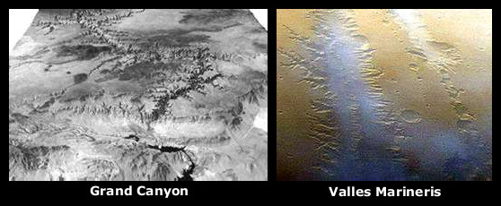
I will continue to ask for any other logical explanation. As you continue to believe in phaulty fysics and skewed dating processes, go ahead and add in all the tangible evidence. Look at the satellite views, study the geography, impactites, historical accounts,... Understand there are pyramids, that were built on top of Chicxulub, buried beneath limestone. This same limestone is what formed the Ozarks and was ejected from beneath the Mediterranean sea...

It really is quite simple, once this has been looked at from this angle. Where else would all this limestone have come from?
[...and so, these, [very intelligent and highly advanced, beyond our current knowledge,] people went out to find the loved ones they knew..., why, what would you do?...]
...
Post Reply