Black Sea anomalies?

Random older topics of discussion

Moderators: MichelleH, Minimalist, JPeters

Forum Monk
Posts: 1999
Joined: Wed Dec 27, 2006 5:37 pm
Location: USA

Post by Forum Monk »

Here are some visulizations from the ETOPO5 database showing the strait of Bosporus under various sea level conditions.

Image

Image

Image

The deep water trough on the south side of the strait (upper part of images) belies the fact that a huge amount of water washed from north to south. Near the actual location of the strait howver, one can see the trough appears filled-in a bit, which does indicate a general flow from north to south as silt and sediments likely did this.
Forum Monk
Posts: 1999
Joined: Wed Dec 27, 2006 5:37 pm
Location: USA

Post by Forum Monk »

It is very interesting that the higher resolution etopo2 database reveals a different result. At 5 meters, the Bosporus is not innundated and even at 80 meters portions remain in tact like a chain of islands. This clearly demonstrates the higher res. datasets are essential to studies of this type. Guess its time to think about downloading etopo30.

Image

Image
User avatar
daybrown
Posts: 336
Joined: Fri Jan 27, 2006 4:46 pm
Location: Arkansas Ozarks
Contact:

Post by daybrown »

<Rivers such as the Don and Danube were flowing into the Black Sea at 40 times current flood volumes during the spring and summer during the Big Melt.>
How is it that the Bosporus could channel that much more water?

Why does the Sakarya, which today is a wadable river, have such a big valley?

Ryan says the above outflow carved the Sakarya valley on its way to the Sea of Marmara. But some nice detailed maps of the bottoms of both the south coast of the Black sea and the NE coast of the Sea of Marmara would let us decide for ourselves.
Any god watching me hasta be bored, and needs to get a life.
User avatar
daybrown
Posts: 336
Joined: Fri Jan 27, 2006 4:46 pm
Location: Arkansas Ozarks
Contact:

Post by daybrown »

I appreciate the maps FM, but I dont believe the topography was the same back then. As mentioned, the loss of the glacier weight caused uplift. which is still going on in some parts.

the last map shows a finger of the Sea of Marmara spread out East as if it was part of a channel that was once lower. Its really difficult to sort this out because I've seen reports that the Sea of Marmara area is diving under the European plate, while further East, the Northern Turkey is rising. the buckling is part of the reason for the frequent powerful earthquakes there.

I dunno that we have good data on the ancient topography, but if 40 times the current flow were spilling into the Sea of Marmara, there awta be a pretty substantial channel running between the depths of the Euxine basin to wherever it was getting out.

You map shows a level where there would be several spillovers. But water dont work that way. It'll spill first at one point, then carve that one point a lot deeper and wider as the rate of flow increases. You do get multiple channels in river deltas, but that's from the deposition of sediment as the current slows when it nears the sea level.

Does your source run the water level lower so we can see what channels still lay on the bottom like the Danube and Don?
Any god watching me hasta be bored, and needs to get a life.
User avatar
Cognito
Posts: 1615
Joined: Fri Jul 28, 2006 10:37 am
Location: Southern California

Black Sea

Post by Cognito »

DB, try this one for Black Sea level changes during the last 20,000 years, then decide for yourself:

http://gsa.confex.com/gsa/responses/2003AM/33.doc

I'm still looking for a bathymetric map for the north side of the Bosporus. By the way, the comment regarding 40 times current volume refers to glacial surges during the melt phase only (Ref: Andrey Tchepalyga, Institute of Geography, Russian Academy of Science).
Natural selection favors the paranoid
Forum Monk
Posts: 1999
Joined: Wed Dec 27, 2006 5:37 pm
Location: USA

Post by Forum Monk »

It goes without saying, we are not going to know what the topographical landscape looked like in remote ancient times. We can only make reasoned guesses.

Finding detailed bathymetric data for the area in question is not so easy, as I have also looked through the conventional resources. There is good "above seal level" data but not sub-sea. Perhaps due to the political sensitivities of the region, who knows.

Having investigated, the 30 arc second dataset (which I now have the Bosporus tiles) only contains elevations from about 1 meter and up. Nothing below sea level. This is disappointing since it makes it impossible to lower sea levels to see what kind of structures may be revealed. I would be able to raise them. I can combine the data with existing bathymetric datasets but it is a lot of work better suited to those who get paid for such analysis, IMO. My area of interests usually lies in stellar cartography but this is an interesting excursion as well.

I'll run the sea level down and we'll see what is revealed.
Forum Monk
Posts: 1999
Joined: Wed Dec 27, 2006 5:37 pm
Location: USA

Post by Forum Monk »

Having lowered the sea level 120 meters to LGM estimated minimums, I changed the position of the light in order to coax out as much detail as possible. The area of the mouth of the Danube is non-descript resembling a plain with little or no detail, so I decided not to waste the band-width posting it.

The Don River delta region and the shallow Azov sea is a different story. Here is the image as it would appear with the sun from the north east at minus 120 meters seas.

Image

Below, I have annotated the approximate path of the river and a curious channel/valley which appears to feed the drained Azov from the east. It appears to be a channel for water passing between the Black Sea and the Caspian. Pretty much as Cognito has been pointing out for some time.

Image
kbs2244
Posts: 2472
Joined: Wed Jul 12, 2006 12:47 pm

Post by kbs2244 »

FM:
I don’t know where you have been looking for your sub sea level topo information, but they are well along in digging a subway tunnel under the Bosporus. (How would you like to ride that twice a day?)
I don’t know where you would start, but a civil engineering type search may turn something up.
User avatar
daybrown
Posts: 336
Joined: Fri Jan 27, 2006 4:46 pm
Location: Arkansas Ozarks
Contact:

Re: Black Sea

Post by daybrown »

Cognito wrote:DB, try this one for Black Sea level changes during the last 20,000 years, then decide for yourself:

http://gsa.confex.com/gsa/responses/2003AM/33.doc

I'm still looking for a bathymetric map for the north side of the Bosporus. By the way, the comment regarding 40 times current volume refers to glacial surges during the melt phase only (Ref: Andrey Tchepalyga, Institute of Geography, Russian Academy of Science).
Thanx Cognito. But I dont have an opinion on a channel between the Caspian and Euxine basin.

I dont see that one would have much affect on the already extant agrarian communities further west in the Danube & Dneipr areas. East of the Dneister, the climate was colder, drier, and not useful given the agrarian techniques at the time, so any populations there were nomads or hunters, too mobile for any flood to create much of a problem.

Mallory can find only a few settlements, perhaps a few thousand people in total all the way East from the Don, not enough of a population to have their mythic report of a great flood remembered. But if you add up all the tels and towns West of the Euxine, it gets to something like 4 million in the kind of active trading network it would take to create a unified language, namely Proto-Indo-European.

I'll await better maps of the bottom before I try to figure out all the anomalies in the PIE record that point to a mythic great flood and the replacement of a freshwater lifestyle with a marine lifestyle.

This is, as noted, so loaded with political and religious sensibilities that I cant trust anyone's *opinion* on what was going on. Show me the map. Ryan and Pitman say there was an outflow at different times thru the Sakarya valley. Well, if so, then below the current sea level, there will be the channel, just like we see the channel of the Don and the Danube. And if not, well- then not. Its real simple.

Ryan and Pitman also say that North of the Bosporus, there are huge house size rocks laying on the bottom that were blasted out by the flow. Anyone got a link with a sonar image of these? Are they there, or not? I've seen this rebutted by saying that it was uplift. Well, if so, then these kinds of rocks will be all along the bottom from Sinope west to the Bulgarian line, and not just north of the Bosporus. Are they there? Or not?

Given the controversy that has gone on all this time, why hasnt someone looked?
Any god watching me hasta be bored, and needs to get a life.
Minimalist
Forum Moderator
Posts: 16035
Joined: Mon Sep 26, 2005 1:09 pm
Location: Arizona

Post by Minimalist »

Good point about the uplift, DB.

Here's a modern photo of the Pass of Thermopylae.

Image
View of the Thermopylae pass at the area of the Phocian Wall. In ancient times the coastline was where the modern road lies, or even closer to the mountain.

As noted in the caption 2,500 years ago the shore line was much closer to the mountain. Thermopylae is not all that far from the Bosphorus.
Something is wrong here. War, disease, death, destruction, hunger, filth, poverty, torture, crime, corruption, and the Ice Capades. Something is definitely wrong. This is not good work. If this is the best God can do, I am not impressed.

-- George Carlin
User avatar
Cognito
Posts: 1615
Joined: Fri Jul 28, 2006 10:37 am
Location: Southern California

Manych Straits

Post by Cognito »

FM, the "possible channel" you listed on your map is the Manych Straits area on the North Caucasus Isthmus. From 15ka to 11ka the Caspian was connected to the Black Sea via that pathway with the flow of water being referred to as the Khvalynian transgression.

http://www.icms.com.au/inqua2007/abstract/193.htm
Natural selection favors the paranoid
User avatar
daybrown
Posts: 336
Joined: Fri Jan 27, 2006 4:46 pm
Location: Arkansas Ozarks
Contact:

Post by daybrown »

Thanx for the link Cognito.
<http://www.icms.com.au/inqua2007/abstract/193.htm>
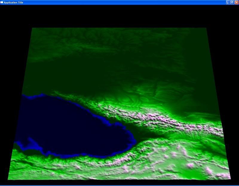
It'd be much more informative to us who are not familiar with the geological nomenclature if he posted a series of maps to illustrate when and where he thinks water, salt or fresh, was going.

Because of the effect of the weight of the glaciers, then the weight of the water released, and the combination of tectonic forces going on in the region then, before, and since, its really hard to nail down what was going on.

The data on Proto-Indo-European, and the derivative languages is likewise complicated by the evolution, which we assume followed the rules of etymology still going on. Is that a safe assumption in a region that had poorly defined populations and DNA lines that kept moving around?

There are, nevertheless, curiosities that the putative Great Flood explains to some significant degree. In Greece, the Balkans, and on up to the Danube to Dneistr drainage basins we do have the dendochronology going back 8000 years which indicates a consistent climate. But further east, we move beyond the tree line, into areas of the Steppes where chronic drought precluded much early agriculture and the timber frame constuction that left us the post stubs to date sites with.

Tripolye, on the Dneistr is the only and most eastern site I know of, that while I think its a really interesting place is too late to testify directly on a Great Flood. However, it did exist at the start of the domestication of the horse. We can see how the horse, cart, other livestock, bronze, and writing would have spread with the Aryan stockbreeding onto the Steppes, and then even more widely dispersed, all the way down to the Levant and India during bad droughts further north.

We see how drought produced a domino effect that resulted in Attila & a horde crossing the Danube, and while not intended as an invasion, had that effect. No reason to think that was the first time.

But there's another clue in an obscure, self published work:"Did The Proto-Indo-European Priesthood Commit Treason in the Period of PIE Unity?" Its a remarkable work, published with a PC printer in 1988.

At first, the scholarship looks like the genius of a Gibbon, but considering the power of PCs to deal with ascii copies of text by 1988, Ballantine & Oswald worked in Seattle and Germany. Why Seattle? Microsoft. Why Germany? the university sources of really obscure German, Latin, Greek, Sogdian, Sanskrit, documents and a computer derived version of Proto-Indo-European.

They show how clerics in all the Indo-European languages share phrases and forms in ritual, characteristics of liturgical costume, and cultural restraints. Even in the video games we see that a "priest" may not wield a weapon that draws blood, but must use a mace.

They also use software to calculate solar & lunar eclipses. And do it in the 6th mil BC. I've not been able to find that software they used, but I recognize the ASCII 9 pin IBM proprinter output. (I have one of those in the shed, and every time a printer dies, I go get it and use it till I get a new one. Its outlived 4 printers since. That damn thing will run forever)

So- I've not been able to verify the dates. But from 5559 BC to 5525 BC they show a remarkable series of 30 solar eclipses, many of which they calculate were visible from Anatolia on NE over the Caucuses and across the Steppes.

They think that these cosmic wonders triggered a failed rebellion on the part of the priestly classes. I can see how dudes like Pat Robertson and Jerry Fallwell would certainly give it a shot.

But for sure, they are not the only people who think something big happened in the middle of the 6th millennium. And they thot so long before Ryan and Pitman published. There has long been the problem of just where the original home of the Aryans was,

We have Tripolye, that city found in the Kara Kum, The graveyard at Varna, and a few other places from the 4th mil, and there are common characteristics in all these places, indicative of a dispersion that was already going on, but no clue on any central power center.

I think this is because we are not looking at a military empire, but a mercantile network which was antecedent to the Silk Road, which was an enormous cultural force well documented, but it didnt have a center either.

There is an earlier diffuse network in the Danube to Dneistr basins, that include pottery known as Vinca, Petresti, and most famously, Cucuteni- which evolved into Tripolye. And while we can see the trade network, there was some kind of seminal event- which Ballard and Oswald pick up on, that really put people on the move.

In just the last couple of years, since Ryan & Pitman published, the Iranians have dug up a number of sites "xxxx-Tepe" that all seem to suddenly show up in the late 6th mil. Where did all these farmers come from, and why do they show up then?

What Ballantine and Oswald dont realize is that the priesthood in the 6th mil was female. This is why they dont use bladed weapons. this is why the pope wears lace, a gown, not pants, and runs around with a tall hat to hide a beehive hairdo. Why the beehive? Fat bitches still wear them thinking they make them look taller and thus not so obese. Gimbutas shows us lots of them from the 6th mil.

But it sure looks like something big happened in the mid 6th mil. If it was not the Great Flood, then what was it? If there really were a series of eclipses in that era, passing over an already severely stressed tectonic zone, I can see where there'd be some 8 Richter or even worse quakes that would fracture the aquifers and open up the Bosporus in a really dramatic way.

Just last spring I saw a TV presentation about a Turkish fault zone that runs across Northern Turkey from the Caucuses to the bottom of the Sea of Marmara, which is, in fact, a rift valley. They dig into the historical record and see how quakes ripple across Turkey from West to East like dominos that fall over about 20 years apart, and if you remember the quake which produced the subsidance on the Marmara coast, you can understand why they thot the next one, the end of the line in the bottom of the Sea of Marmara, would be "The big one."

The erratic nature of these quakes, which alter the topography, really mess with the calculations about where water- which likes to flow downhill- went.
Any god watching me hasta be bored, and needs to get a life.
Forum Monk
Posts: 1999
Joined: Wed Dec 27, 2006 5:37 pm
Location: USA

Post by Forum Monk »

daybrown wrote:They also use software to calculate solar & lunar eclipses. And do it in the 6th mil BC. I've not been able to find that software they used,...
So- I've not been able to verify the dates. But from 5559 BC to 5525 BC they show a remarkable series of 30 solar eclipses, many of which they calculate were visible from Anatolia on NE over the Caucuses and across the Steppes.
I can tell you with reasonable certainty DB, that you can not find the software because it does not exist. Ninety-nine percent of astronomical software can not compute with any degree of accuracy prior to 1 Jan 4713BC since this is time zero for the Julian calendar which most software is calibrated by.

Certain events can be approximated by software in any case and if you find one of the software products that allow it, (e.g. "Starry Night Pro" I believe) it will provide a reasonable approximation of positional astronomy prior to year zero. For example, the period of precession is roughly known, the saros cycle of eclipses has not changed. But the ability to accurately calculate the path of totality or the approximate path of the umbra is nearly impossible since the rotation of the earth is far from regular. Astronomy software provides for the input of leap seconds to compensate the irregularity. The further back in time we go, the more the correct leap second value becomes a guess based on ancient descriptions of eclipses from various locales.

An eclipse will occur over a region every 18 years, 11 days, 8 hours which means, because the period is fractional, the hour the eclipse occurs is later each cycle, resulting in some years, the eclipse is not visible at all.

Its not complicated in general, (the ancients were aware of it) but precise tracking of the shadow is much more complicated.
The Earth is constantly undergoing a deceleration caused by the braking action of the tides. Through the use of ancient observations of eclipses, it is possible to determine the average deceleration of the Earth to be roughly 1.4 milliseconds per day per century. This deceleration causes the Earth's rotational time to slow with respect to the atomic clock time. Thus, the definition of the ephemeris second embodied in Newcomb's motion of the Sun was implicitly equal to the average mean solar second over the eighteenth and nineteenth centuries. Modern studies have indicated that the epoch at which the mean solar day was exactly 86,400 SI seconds was approximately 1820. This is also the approximate mean epoch of the observations analyzed by Newcomb, ranging in date from 1750 to 1892, that resulted in the definition of the mean solar day on the scale of Ephemeris Time. Before then, the mean solar day was shorter than 86,400 seconds and since then it has been longer than 86,400 seconds.
Src: http://tycho.usno.navy.mil/leapsec.html
User avatar
daybrown
Posts: 336
Joined: Fri Jan 27, 2006 4:46 pm
Location: Arkansas Ozarks
Contact:

Post by daybrown »

Yes I know FM; I've not been able to find anything that went back before 3000BC. But be that as it may, the fact remains that the region is tectonically very fragile, and I can see ancients being far more than moderns of a connection between moon phases and disasters.

They didnt have streetlights, and relied on moonlite for rituals. Nor am I so ready to say what ancients didnt know. And besides the question of what was going on that had such a huge cultural impact in the 6th mil, there are curiosities in ancient text as well. In Genesis, it says the "Fountains of the deep gushed forth". I think in the original Hebrew this mean that springs became artesian fountains.

You dont get that with rain, which distributes hydraulic pressure evenly over both the land and sea. But you would with a dramatic rise in the water level in a close drainage basin like the Euxine. The pressure would back up in the aquifers.

Then in Gilgamesh, he goes back to some sacred site to dive down thru the water to retreive some same magic item. Again, he's not going to have the problem if the water rose slowly. There'd be plenty of time to gather up and remove everything of value. But yet, it has to rise rapidly, and then level off, so as to not be too deep for a dive. This would have been the case as the shoreline communities were flooded, but then the water spreads out thinly across the alleuvial paleolithic deposits of the Danube delta, and there'd be a point at which the treetops would still stick up above the water to tell the hero where to dive.

If we consult with the chart Hodder has, we can see most Anatolian cities were abandoned at the end of the 7th mil. From then, until the Great Flood, there'd be something like 500-700 years of occupation of the remarkably fertile Danubian floodplain, that that would leave some characteristic habitation mounds.

we see this in river delta land ever since agriculture, that spring floods force people to build their homes only on such natural high spots, dunes or the natural levees that form. This would have concentrated habitation. If there was any.

The French Quarter for instance, is at a place where flood waters coming round a bend spread out over the banks, and when slowed, dropped silt, which in time builds up a natural levee. Below New Orleans, all the way down to Venice, there are orange groves in the highest ground around, that is, next to the river itself. As you move further way it gets too swampy, so the useful land is only a strip 1/4mi wide.

that would have been the case along the Danube as it drained into the Euxine lake as well. So- if there were any settlements before a putative Great Flood, they would be on these natural levees. It seems crazy, that on these riverine floodplains, that the highest ground is right next to the river, but that is the way it works. (the French Quarter didnt flood.)

Yet, nobody has bothered to look.
Any god watching me hasta be bored, and needs to get a life.
Beagle
Posts: 4746
Joined: Fri Apr 14, 2006 2:39 am
Location: Tennessee

Post by Beagle »

http://news.yahoo.com/s/nm/20071118/sc_ ... .X8wIE1vAI
LONDON (Reuters) - An ancient flood some say could be the origin of the story of Noah's Ark may have helped the spread of agriculture in Europe 8,300 years ago by scattering the continent's earliest farmers, researchers said on Sunday.

Using radiocarbon dating and archaeological evidence, a British team showed the collapse of the North American ice sheet, which raised global sea levels by as much as 1.4 meters, displaced tens of thousands of people in southeastern Europe who carried farming skills to their new homes.

The researchers said in the journal Quaternary Science Reviews their study provides direct evidence linking the flood that breached a ridge keeping the Mediterranean apart from the Black Sea to the rise of farming in Europe.

"The flooding of the Black Sea was not well dated but we got it down to about 50 years," said Chris Turney, a geologist at the University of Exeter, who led the study. "As soon as the flooding is done, farming goes crazy across Europe."

The researchers created reconstructions of the Mediterranean and Black Sea shoreline before and after the rise in sea levels. They estimated the flood covered some 73,000 square kilometers over a 34-year period, causing mass displacement of people.

Previous archaeological evidence has shown communities in the region were already farming when the flood hit. The Exeter team suggests the mass migration caused a sudden expansion of farming and pottery production across the continent.

"We looked at all the earliest data on farming in Europe and we found a little bit of farming in Greece and the Balkans just before the flood," Turney said in a telephone interview. "When the flood happened, farming seemed to stop but it was re-established a generation later across Europe."

The researchers believe these people took their skills to new areas previously populated by hunters and gatherers where there had been no evidence of farming, Turney said.

The study also underscores the potential impact rising sea levels may have in the future, the researchers said. An expected one meter rise by the end of the century due to climate change would displace some 145 million people, Turney added.

It also paints a picture of the kind of mass disruption that has prompted some scientists to link the ancient flood to the origins of the biblical story of Noah's Ark, Turney said.

"When the Black Sea flooded at end of last ice age some people have suggested it was the origins of the Noah's Ark myth," he said. "If you lived in that basin it would have seemed like the whole world had flooded."
New article - new study. It may answer some questions.
Locked